Total miles: 34684. Trip miles: 401.4. Gallons: 8.398. Price per gallon: $2.699.
Screen mileage: 49.3 mpg. Tank mileage: 47.8 mpg.
Saturday, October 31, 2009
Saturday, October 24, 2009
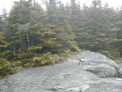
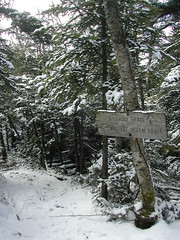
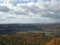
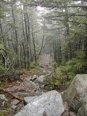
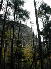
mt osceola near parking lot
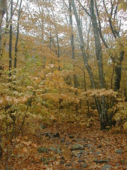
mt osceola near parking lot
Originally uploaded by wereldmuis.
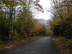
Here I'm on the way back to the car, very close to the parking lot. In this area the foliage was still lovely. The rain made the colors very vivid.
Despite all the rain, and some trouble with ice, this was a really cool hike, exhilarating even! Hiking through all the water made me feel like I was being absorbed into the outdoors. I was also glad to bag my third 4000-footer.
The total hike was a distance of 6.4 miles. It took me 4 h and 40 min for a pace of 1.4 mph. Not so bad, given the conditions... The elevation gain is 2050 feet, according to the White Mountain Guide. I will have to go back some day, to cover the section of trail between E Osceola and Mt Osceola.
What a great day! I wonder if I will be able to do any more hiking in the Whites before winter comes in for real?
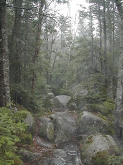
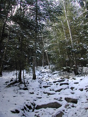
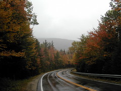
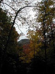
mt osceola trail stream
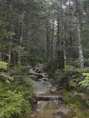
mt osceola trail stream
Originally uploaded by wereldmuis.
Here's another shot of the trail doing its imitation of a stream, on the way back down. It had only stopped raining while I was at the summit. All of the accumulated rain and melting ice was flooding the trail even more on the return trip. This meant I got to see some very beautiful waterfalls, some of which I had to cross through as they passed over the trail!
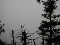
mt osceola summit ice and wind

mt osceola summit ice and wind
Originally uploaded by wereldmuis.
I walked out on the ridge just a little to get a photo... the wind was an incredible force! I just took this shot and went back.
Since everything was covered in ice, I decided not to take a break to eat something at the top - nowhere to comfortably sit! Instead, I immediately began to retrace my steps.
mt osceola summit ice
mt osceola summit ice
Originally uploaded by wereldmuis.
Once I got to the ridge, I was again faced with ice covered rocks. In addition, there was an unbelievable blasting wind coming in to the mountaintop here.
Fortunately, the temperature was well above freezing. so I could stand to walk around a little. But the ice and wind severely limited the exploring that I could do.
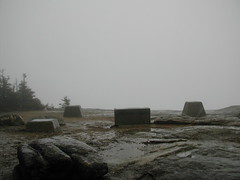
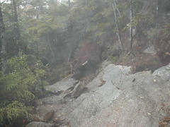
mt osceola summit is flooded
mt osceola summit is flooded
Originally uploaded by wereldmuis.
From the old fire tower footings, I followed the path to a clearing along a ridge. The summit was a strange combination of water and ice. The trail passed through the biggest pools of water I'd encountered so far. They were haflway frozen, with ice slabs standing on top. I could feel ice crunching under my boots as I walked through them.
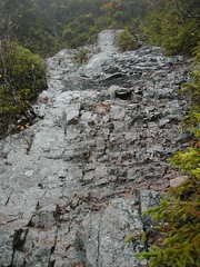
mt osceola summit covered in ice
mt osceola summit covered in ice
Originally uploaded by wereldmuis.
As I approached the summit, the going got more difficult. Sections of the trail here are partially blocked with huge walls of sloping rock that give you little or no room to get by on the flat. There are many areas where you have to set your boots on a sharply sloping rock. And it was just around this area that most of the rocks had accumulated a slippery coating of ice, perhaps a quarter inch thick. Bummer!
Fortunately, it had been raining pretty much nonstop since I started, and there were streams of fresh running water going over the rocks. Wherever the streams rushed, the ice was gone. So I learned to just put my feet very carefully wherever there was running water. This got me most of the way. Very close to the summit I had some difficulty clambering up a few ice covered boulders, but I managed without slipping.
In this photo, I've reached the old fire tower footings at the summit. Here, the rocks were completely covered in ice! Not sure how well that comes through in the photo.
I took off my backpack and set it down here to look around, taking tiny mincing footsteps to avoid falling.
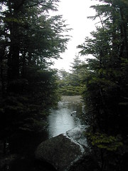
wet trail
wet trail
Originally uploaded by wereldmuis.
Most of the trail was extremely wet - literally running with water, like a stream, or covered in standing pools. By habit, I started out by trying to avoid walking in the water. But I quickly gave up and just went straight through the pools, often stepping into water that covered several inches of my boots. They remained excellently waterproof.
All my gear held up pretty well, actually, except my mittens got completely soaked - and I thought they were waterproof! Also, I continue to have the problem that water drains into my sleeves whenever I raise my hands up. Not sure what to do about that, but I'll have to find some solution. Overall, I stayed reasonably dry and warm despite all the water.
As I approached the summit, I passed the two guys who, I surmised, were heading back to their big black truck. One of them joked "I think I left the keys in the truck!" - guffaw! It appeared that I would soon be the only soul on the mountain... neat!
ice
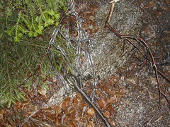
ice
Originally uploaded by wereldmuis.
As I started out on the trail, there was a light rain. The car thermometer read 39 °F, but it felt warmer.
The Mt Osceola trail is pretty gentle for most of the way to the summit. There are a number of switchbacks which make the trail longer, but less steep.
At some point, I'm guessing about halfway up, I started to see bits of branches and red berries, coated in ice, apparently broken off and fallen onto the trail. Of course, I was wondering how much ice I'd find as I continued onward.
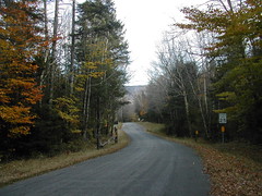
mt osceola trailhead
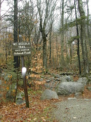
mt osceola trailhead
Originally uploaded by wereldmuis.
I finally made it to Mt Osceola today! This is the trailhead. There were some water droplets on the lens; it was raining lightly when I got there. There was me and a big black truck in the lot, that's all. Nice and quiet - amazing what a little rain will do to clear the trails.
I almost didn't go, but I'm glad I did. It was almighty hard getting up this morning, and as I sat around sipping my tea trying to decide what to do, I had strong misgivings about the potential for ice near the summit. As it turned out, there was ice, but it was manageable.
Thursday, October 22, 2009
Tank ninety-five
Total miles: 34283. Trip miles: 369.1. Gallons: 8.167. Price per gallon: $2.599.
Screen mileage: 49.3 mpg. Tank mileage: 45.2 mpg.
Most of the tank was used in a round-trip drive of about 2.5 hours each way at 65 mph. But there was some dirt road driving and city commutes, too. It's getting colder, which accounts for the lower mileage.
Screen mileage: 49.3 mpg. Tank mileage: 45.2 mpg.
Most of the tank was used in a round-trip drive of about 2.5 hours each way at 65 mph. But there was some dirt road driving and city commutes, too. It's getting colder, which accounts for the lower mileage.
Sunday, October 18, 2009
tripoli rd gate west end
tripoli rd gate west end
Originally uploaded by wereldmuis.
Here's the summary of my trip:
- The entire loop was 10.4 miles, which I covered in about 5.5 hours of hiking, for an average pace of about 1.9 mph. The elevation gain from the ski area to Mt Tecumseh's summit was 2200 ft.
- There was no self-serve parking along Tripoli Rd!
- There was snow!
- You can park at Waterville Valley free of charge!
- Both the east and the west gates are open at Tripoli Rd, at this time.
- As I drove past the Mt Osceola parking lot for the last time, I saw an ambulance in the lot, lights flashing. Be careful out there!
- Doing Mt Tecumseh trail as a loop is certainly feasible, but not something I'd prefer to do often.
- At this rate, I wonder when I'll ever make it to the summit of Mt Osceola.
- the plan
- self-serve surprise
- Mt Tecumseh trailhead at Waterville Valley Resort
- start of the hike
- Tecumseh Brook
- a bit of snow
- the turn of the trail
- blue skies
- recrossing Tecumseh Brook
- interlude at ski trail view
- there's snow on them thar hills
- steeper, snowier
- Tecumseh meets Sosman
- summit either way
- Mt Tecumseh cairn
- View from Mt Tecumseh
- bird
- Moosilauke view
- Tripoli Rd walk
- Tripoli Rd continues
- back to Waterville Valley
For more info, you may want to check out these web sites:
- Hiker Matt also ran into snow in Nov 2008, but it doesn't look so deep as what I saw.
- Chris Oberg's trip report from who knows when.
- Some random site's trail description - beware, it contains a typo saying to get off on Exit 32 to get to Tripoli Rd, a typo that cost me even more in wasted time. It should have read Exit 31!
- David Metsky's trip report, later in the season of 1998.
- dirt_girl's trip report from August 2004. She did the Mt Osceola trail followed by Tecumseh, which was my original plan.
climb to waterville valley ski area
climb to waterville valley ski area
Originally uploaded by wereldmuis.
After what seemed like ages, I finally came to the turn off for the Waterville Valley ski area. At this point, the road goes sharply uphill - not the best way to end a hike! And there was even more traffic up and down from the resort. When I drove down, I discovered it's 0.7 miles from the turn off up to the parking area.
The entire distance from the Mt Tecumseh trailhead on Tripoli Rd back to the parking area at the Waterville Valley Resort is almost exactly 5 miles, and I did it in 2 hours - a pace of 2.5 mph. So it really wasn't as bad as it seemed; I think I was expecting it to be quicker, and I didn't like traveling out on a road for so long.
tripoli rd view
tripoli rd view
Originally uploaded by wereldmuis.
I wasn't expecting the walk along Tripoli Rd to take as long as it did, and at some point it seemed endless. There are some nice views along the road... but I was passed by a car every five minutes or so.
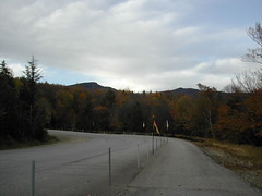
osceola trailhead off tripoli rd
osceola trailhead off tripoli rd
Originally uploaded by wereldmuis.
From there on, the rest of the trip down to Tripoli Rd was pretty uneventful and relaxed, a slow and gradual descent. The entire trail, a distance of 5.6 miles from end to end, took me about 3.5 hours excluding breaks, for a pace of 1.6 mph.
At this point it was just a matter of following Tripoli Rd back to the ski area. It's a dirt road for a while. When I had driven over it earlier, I hadn't realized that it climbs for quite some time before finally descending.
As I passed the Mt Osceola trailhead again, I could see that cars had overflowed the parking lot and were spilling out along the road, as seen in this photo.
moosilauke view
moosilauke view
Originally uploaded by wereldmuis.
Very soon, I had to store away my food bar, and put on the mittens that I'd brought along just in case. The trail heads down very steeply here after leaving the summit to the west. Even without the snow, I would have had to climb down using hands and feet. This is the most difficult section of the entire trail, and it doesn't last long. It's perhaps a 20 or 30 foot drop till the trail moderates.
After that, the trail gradually descends, fooling you into thinking you are done with climbing. But then it gradually begins to ascend, and soon you are going back up, up, up. The AMC White Mountain Guide says you cross three knobs. I didn't count them; I think the first climb was the steepest, and after that there were just a few minor bumps till I began to descend again.
The guide says there's a short trail to the left which leads to a view of Moosilauke from the third knob (p 338). I happened to notice what looked like a trail, all snow-covered, and followed it about 30 yards to the view. Nice! And the weather was still behaving nicely, the sun peaking out from behind clouds now and then.
grouse on tecumseh
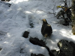
grouse on tecumseh
Originally uploaded by wereldmuis.
As I departed Mt Tecumseh, I noticed this bird up ahead sitting on a boulder that stuck out into the trail. I slowly reached for my camera, expecting it to fly away, but it just sat there twitching nervously. I got a few shots in, approaching slowly.
Even when I passed it closely as I went around the boulder to continue my hike, it didn't fly away. It scrambled around the boulder a bit, but always remained in view. I'm not sure what it is; perhaps some sort of grouse. It's a pretty large bird, bigger than a pigeon.
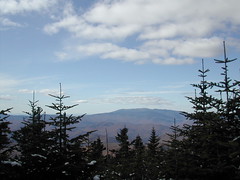
view from mt tecumseh

tecumseh view
Originally uploaded by wereldmuis.
This is the best/only view that I saw looking out from near the cairn at the summit of Mt Tecumseh.
Once I had decided to continue on towards Tripoli Rd, I got moving. I took a few bites from a sweet'n'salty food bar (yum) and headed on out.
cairn at mt tecumseh
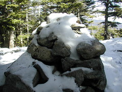
tecumseh cairn
Originally uploaded by wereldmuis.
This is the cairn at the summit of Mt Tecumseh.
I didn't stay here long. As soon as I stopped to look around, I started to feel the cold. With snow covering everything, I didn't feel like hanging around to explore.
There was only one obvious viewpoint, a break in the trees to the southeast (I think).
I wandered around the summit briefly, trying to decide what to do. It was 1 pm, and I was confident I could make it down to Tripoli Rd before dark, turning the hike into a loop, if I really wanted to. However, there was still that risk that I didn't know what to expect going down the other side of the trail. I waffled a bit and spontaneously decided to go for it. I also randomly predicted that it would be only about two hours of hiking from the Tripoli Rd trailhead back to the ski area. This turned out to be correct, for no reason I can think of, since I didn't bother to estimate the distance by looking at my trail map!
two routes to summit
two routes to summit
Originally uploaded by wereldmuis.
After following the Tecumseh trail a bit further, you come to another fork. The Sosman trail goes straight on and down, and the Tecumseh trail goes off to the left. Both branches lead to the summit, as the sign indicates.
I continued on the Tecumseh trail. Beyond this point, getting to the summit proved a little tricky. The trail is mostly level, but there's a point where there are lots of rocks to crawl over, and the trail drops off steeply to one side. There are trees to that side so it doesn't feel too dangerous. Normally it would have been no trouble at all, but with the snow, it made sense to be extra cautious.
mt tecumseh meets sosman trail
mt tecumseh sosman trail splits
Originally uploaded by wereldmuis.
This is where the Sosman trail first meets up with the Mt Tecumseh trail as you're coming from the east. I turned around, looking back, to take this picture.
I've read some trip reports that make it sound like this trail used to be poorly marked. But all the signs seemed pretty clear to me, including this one.
If it hadn't been for the snow, I would have explored the Sosman trail, which is pretty short, but I decided to stay on Tecumseh.
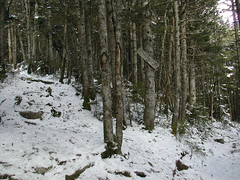
steeper and more snow
steeper
Originally uploaded by wereldmuis.
As I approached the summit, the trail got even more steep, and there was about an inch of snow over everything. My pace slowed a bit, but it was still very doable. At this point I had decided that I should probably go back the way I came, rather than attempting a loop, since I wouldn't know what conditions existed on the other end of the trail.
Despite the snow, the trail was still busy enough. I passed about five small groups of two or three people during the entire trip.
boots in the snow

snow close up
Originally uploaded by wereldmuis.
Once you leave the ski trail, the climb becomes more straightforward - up and up. It's rocky, and fairly wide, but steeper than the trail had been up till this point.
Soon, snow completely covered the trail and clumps of it clung to the evergreen trees around me. Fortunately, the snow was very sticky. I was careful about how I stepped, and avoided any serious slips.
My boots performed well in the snow. I'm still pretty happy with them, although I did get some pretty nasty rub marks just above my heels, despite the judicious use of Dr Scholl's blister treatment cushions. Those have been helpful so far. I think they helped again, here, but not as much as I'd hoped.
view from the ski trail
view
Originally uploaded by wereldmuis.
Soon after recrossing Tecumseh Brook, you can take a short spur to the left of the trail to walk out onto a ski trail, where there's a great view.
The vast ski trail which sprawls below you is kind of ugly, and I framed this photo to exclude it!
snow at brook crossing
snow at brook crossing
Originally uploaded by wereldmuis.
As I hiked on, the amount of snow on the trail increased. Here, at 1.1 miles, the trail recrosses Tecumseh Brook. There was a light smattering of snow over most of the trail at this point.
The trail is relatively easy up till here. There's a gradual uphill climb, but nothing too strenuous. That worried me a little, because it meant that a lot of the 2200 feet in elevation gain still had to be climbed over the next mile.
Just looking at the map now, it appears you've gained about 700 feet or so here, more than I had realized.
I was also beginning to wonder just how much snow I'd find as I continued on. I definitely had it in my mind that I might have to turn back before reaching the summit. A dismal thought!
sky is blue

sky is blue
Originally uploaded by wereldmuis.
I enjoyed looking up and seeing blue sky - excellent day for a hike! There's still quite a lot of beautiful fall foliage, too.
go right, here

go right, here
Originally uploaded by wereldmuis.
The AMC White Mountain Guide says that the trail crosses the brook at about three-tenths of a mile in - that's here. There's a small cairn to mark the spot, and a small pile of branches "block" the trail just beyond it.
However, I was oblivious and wandered on up beyond the cairn for a while, where the trail slowly petered out. I had only been walking for about 10 minutes, and didn't expect to reach 0.3 miles so soon. At this point I "noticed" that the trail was unmarked - surprising, since the guide book had not mentioned that the trail was unmarked! In fact, the trail was not unmarked; what I had "noticed" was that I had wandered away from the trail.
I strolled back down the trail wondering what to do, and then I realized that I had missed the brook crossing, which now appeared to be clearly marked with a cairn. There were yellow trail blazes, too, but there's no big yellow arrow pointing the way at this spot.
the white stuff is snow

the white stuff is snow
Originally uploaded by wereldmuis.
As I walked along beside Tecumseh Brook, I looked down and noticed a bit of snow. Charming! Must be left over from that bit of precipitation a few days ago.
trail beside stream

trail beside stream
Originally uploaded by wereldmuis.
The Mt Tecumseh trail starts out as a nice ramble past Tecumseh Brook. Beautiful day! At this point, I was beginning to leave behind my frustration at the parking fiasco.
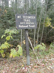
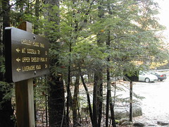
tecumseh trailhead
tecumseh trailhead
Originally uploaded by wereldmuis.
Here's a close up view of the trailhead sign at Waterville Valley Ski Area. It's 2.2 miles to the summit from here, and 5.4 miles to Tripoli Rd.
In the back of my mind, I was considering hiking over to Tripoli Rd and then walking back along the road to make the hike into a loop. At this point, I had no clue that I'd find snow on the trails. The temperature was in the thirties right here, but I figured it would warm up as the day went on.
tecumseh trailhead waterville valley
tecumseh trailhead waterville valley
Originally uploaded by wereldmuis.
I thought about parking without paying the fee, but decided not to risk it. As I searched my mind for other options, I vaguely recalled that the Waterville Valley Resort has a parking area which is mysteriously fee-free. And coincidentally, it is the other end of the Mt Tecumseh trail! So I threw out any plans I'd had to climb Mt Osceola, and drove on over to Waterville Valley.
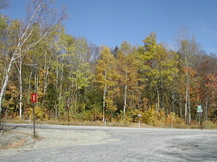
As I passed by the Mt Osceola trailhead, I slowed my car to a crawl to take a look. I was shocked to see that the lot was nearly full! This was around 10 am... I'm guessing either a group had planned to do a hike there, or else this area is incredibly popular because it's one of the easier hikes in the Whites. In any case, I wasn't so dismayed anymore that I wouldn't be able to hike it; it must have been unpleasantly crowded.
It took a little hunting to find the Mt Tecumseh trailhead at Waterville Valley. I drove up past the main building at the top and circled back before I found it. It's just across from parking area 1, which is where I parked.
In the photo above, center right, if you zoom in, you can see the sign for the Mt Tecumseh trail head.
Note that although the weather forecast had mentioned clouds with a possibility of rain, I was happy to see quite a lot of blue sky at this point.
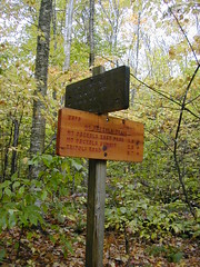
no more self serve??
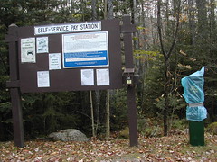
no more self serve
Originally uploaded by wereldmuis.
Possibly the biggest annoyance to hiking in the Whites is that you must pay to park at any trailhead. I believe New Hampshire should change their motto from "Live Free or Die" to "Pay Fee or be Fined" (I also pay $3 in tolls during each visit to the Whites).
In fact, the fee, which is only $3/day (soon to be $5/day) is not so painful to me. Rather, it's the effort that I have to make to pay the fee which annoys me. If I have to buy it in advance, I might as well not go, since I rarely know more than a few days in advance what my plans will be. If I have to go to one of the few WMNF offices to pay, I waste time and gas just to pay a fee which is only a few dollars.
Fortunately, WMNF addresses this issue with self serve pay locations at many of the trailheads. You can stop at any of these areas, grab an envelope, pay the fee, and you're good to park anywhere in the Whites.
Two weeks ago, I used the self serve pay area at the East Osceola trailhead off the Kancamagus Highway. After that worked out so perfectly, I made the foolish assumption that I could continue to rely on these self serve areas for all my trips to the Whites from now on.
Well, yesterday, all of the self serve pay areas along Tripoli Rd were closed. The self serve pay area for camp sites was still available. But I checked the parking lots at East Pond, Mt Tecumseh, and Mt Osceola trailheads. They were all closed - there were no envelopes, and the deposit box was wrapped up in plastic as shown in the above photograph.
I was stymied, and kind of angry - there's no notice as to why this was done, not online and not at the site. It screwed up my plans, and my time had been wasted by driving to a spot where I couldn't park. If I'd known, I would have gone directly to a WMNF office to get a pass. It's out of my way, but close enough that it would have been possible.
[Edit (Oct 24 2009): today I called the ranger station and asked about this. I was told that you don't have to pay for parking wherever the pay stations are covered and the envelopes are gone. Apparently this is standard for some of the self-serve areas once winter approaches. I wish they had posted a notice to make this clear!]
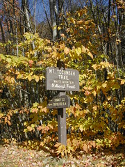
mt tecumseh - second 4000-footer
tecumseh trailhead
Originally uploaded by wereldmuis.
Yesterday's hike: 5.5 h | 10.4 mi | 1.9 mph
For my second 4000-footer, I decided to attempt Mt Osceola and/or Mt Tecumseh. I thought I could park along Tripoli Rd and do both in one day. The Mt Osceola trail from Tripoli Rd is reported to be very easy, compared to my last trip up East Osceola.
The weather has been getting colder, so I was not planning on doing an overnight. Nevertheless, I took my backpack to hold extra clothing in case it rained, or it got colder than I expected. The pack weighed about 15 lbs, including water.
Wednesday, October 14, 2009
appalachian trail view

view
Originally uploaded by wereldmuis.
On our third day of hiking, we did 7.1 miles along the Appalachian Trail in CT, between Rt 341 and Bulls Bridge Rd. We kept a good pace, 1.8 mph or so. My sister has a Garmin Forerunner, and it was fun to try it out.
highest point in connecticut

ma ct
Originally uploaded by wereldmuis.
After passing over Brace Mountain, we followed the red trail blazes to Mount Frissell and on, coming to this little pin which marks the highest point in CT. It reads "MASSACHUSETTS - CONNECTICUT - STATE LINE - 1803 - 1906".
From there we hiked on out to Mt Washington Rd, where we'd placed another car.
view
view
Originally uploaded by wereldmuis.
The following day, we did an end-to-end hike over Brace Mountain and Mount Frissell, which turned out to be shorter than expected. We started our hike from the South Taconic Trail trailhead off Quarry Hill Rd in Millerton, NY. The trail up this way is pretty steep, with a few scrambles up rocky ledges, which can be fun, although I wouldn't want to try it in the rain
tory den on tunxis trail
tory den on tunxis trail
Originally uploaded by wereldmuis.
I took a short vacation with my sister this weekend. The first hike we did was along the Tunxis in CT. This is a look at Tory Den.
Monday, October 12, 2009
Tank ninety-four
Total miles: 33913. Trip miles: 421.4. Gallons: 7.724. Price per gallon: $2.339.
Screen mileage: 53.3 mpg. Tank mileage: 54.6 mpg.
Two longer trips of about 3.5 hours each, some back roads driving but mostly highway miles.
Screen mileage: 53.3 mpg. Tank mileage: 54.6 mpg.
Two longer trips of about 3.5 hours each, some back roads driving but mostly highway miles.
Saturday, October 10, 2009
Tank ninety-three
Total miles: 33492. Trip miles: 235.9. Gallons: 4.99. Price per gallon: $2.399.
Screen mileage: 53.1 mpg. Tank mileage: 47.3 mpg.
Filling up before a long trip.
Screen mileage: 53.1 mpg. Tank mileage: 47.3 mpg.
Filling up before a long trip.
Sunday, October 04, 2009
outside greeley ponds lot down the kancamagus
outside greeley ponds lot down the kancamagus
Originally uploaded by wereldmuis.
When I finally hit the parking lot, I saw that my car was the only one left. It was almost 6 o'clock.
I took a little time to rest, and view the fall foliage along the Kancamagus Highway, something I hadn't bothered to do when I first got there.
The elevation gain from the Kancamagus Highway to the peak of East Osceola is 2216 ft, over a distance of 2.8 miles, and it took me about six hours of hiking to do it. That's a pace of about 1 mph, which seems to be about what I normally do when hauling a backpack over heights. I think I will try to do the two summits again another day, probably without a backpack.
Today, after a good night of rest, just about every muscle in my body is stiff and sore. I can't wait to go back, though!
first view of greeley ponds
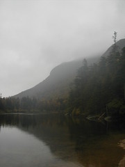
first view of greeley ponds
Originally uploaded by wereldmuis.
I got to Greeley Ponds trail at 4:30 p.m. The sun was setting around 6:30, so I had more than an hour to get back to the car. I decided to take a side trip to Greeley Ponds. I went out about 15 minutes till I hit the first little view by a sandy beach, and then turned back.
On the way back I had to cross the couple of deep streams that I'd passed pretty easily on the way up. They had become deeper now, but fortunately they were still passable.
trail to mt osceola
trail to mt osceola
Originally uploaded by wereldmuis.
This is the trail downhill, as it heads to Mt Osceola from the summit of East Osceola. It's calling me onward!
Once I had reached the cairn, I was curious about how the trail would proceed if I continued towards Mt Osceola. I knew there was supposed to be a steep chimney on the way. There's a trail you can use to avoid it, but I definitely wanted to climb the chimney.
It was tempting to continue on and ascend Mt Osceola, but it was already around 2:30 p.m. at that point, and I knew the descent was going to be arduous and time-consuming. So I decided that pancakes were the better part of valor, and retraced my footsteps.
I had noticed that the boy scouts were using hiking poles on the ascent, and I thought I would try using mine on the way down. After a brief attempt, I decided that they were less than helpful, and stored them away again. Instead, I made my way down most of the rocky parts by climbing down backwards (i.e. facing the rocks, the way you would when climbing up). It was slow going, but my knees thanked me. I've rarely had to do this on a trail before, but this trail is especially difficult, without doubt the most difficult trail I've ever hiked. Normally, I'd slide down the bigger rocks on my butt, but it wasn't comfortable doing that with my backpack on (the bottom of the pack sinks lower than my butt, which made maneuvering difficult).
The trick to climbing backwards is to take a moment to reorient yourself when you turn around again. I found that when you've been climbing down backwards for a minute or two, and then turn around, you can experience a flash of vertigo. This is fine if you just stand still for a moment to reorient. The first time it happened, I nearly lost my balance; vertigo doesn't go well with a loaded backpack on a steep trail.
I traversed the rocky slide this way, as well. I think I could have gone down it face-first if it had been dry, but I decided that it would be helpful to have a handhold for security.
The trip down was actually fairly uneventful. I think I'd become overly nervous at the summit because I had gotten cold. But that's fortunate; if I hadn't been as nervous, I'd probably have attempted the summit of Mt Osceola, which would have been cutting it close - I might have ended up hiking out in the dark. So I think I did the smart thing to head back down when I did.
cairn at east osceola

cairn at east osceola
Originally uploaded by wereldmuis.
This is the cairn which marks the summit of East Osceola. East Osceola is the first peak that I've reached among the 48. I guess I will have to start a list now...
At this point, I was feeling too trepidatious about the climb back down the way I had come to do any sort of victory dance. I decided to celebrate when I reached the parking lot again.
the view
the view
Originally uploaded by wereldmuis.
This is the view from the outlook at the top of the gully, described in the AMC White Mountain Guide (p 349).
I think it was about 5 or 10 minutes after passing over the rocky slide that the trail passed through a steep, sandy, slick gully, and then rapidly leveled off. The troop leader was waving me up, saying that we had reached the summit. The scouts were sitting around taking a break at a short spur trail to the right where there was, in theory, a view. However, there was no view today.
Before leaving their spot, the troop leader invited me to stay at their campsite further on, which was very nice of him. By now, though, I'd become convinced that I'd be wiser to turn back. I looked around at the non-view, and then turning around, I noticed that the trail continued on upwards. So the troop leader had been incorrect, or at least I had misunderstood him; this was not the summit! Still, the trail looked much easier now, so the peak must be near. I continued on up, past a few more steep rocky bits, until the trail went completely level and easy.
rocky slide
rock slide
Originally uploaded by wereldmuis.
This is a view of the rocky slide! It's hard to tell from this photograph, but it's pretty steep. You'll know it as soon as you see it. I guess it's called a slide because you get the impression that you could easily slide right down it off the mountainside.
To give you some perspective, it's about a 20 or 30 foot climb to get from the lower side of the slide to the upper side where the trail continues. It looks more difficult than it is, since there are lots of little horizontal mini-steps to set your feet down on. It's actually kind of fun. It would have been more fun if it hadn't been wet, and I hadn't been carrying a 26 lb pack on my back.
As I crossed it, I was thinking how not-fun it would be if I decided to abort my mission, and had to travel back down this way to get to the car. Going up steep grades is always easier for me than going down. Less slippery.
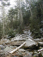
steep and rocky
rocky trail
Originally uploaded by wereldmuis.
This is a view down the Mt Osceola trail, on the way up from Greeley Ponds trail to the summit of East Osceola.
After a reasonable uphill grade, the trail became steeper, and filled with huge rocks that made the climbing difficult. I wound up doing a lot of climbing with my hands, to avoid putting lots of weight on my knees while they were bent.
I had seen several descriptions of a "rocky slide" that was supposed to be along this part of the trail. I kept wondering if I had found it, since I wasn't sure what a rocky slide was supposed to be. In my mind, it would be a long smooth slab of rock; a slide that was made out of rock. I had crawled over numerous slabs of smooth rock. I kept asking myself: "Is this the rocky slide? Is that the rocky slide?" But perhaps they meant a "rock slide", an area where a lot of rocks had fallen down. The entire trail in this area could be called a rocky slide, in that case.
The trail kept getting steeper and more rocky. Around noon, I decided to take a break to eat. I was a little disappointed, because I was hoping to eat at the summit, but the trail seemed never-ending. For lunch, I had an Art's Original Pro Bar (IMHO, it's one of the better bars out there with a good amount of fiber and protein, tastes fresh, and doesn't make you gag).
I had been nice and warm due to exertion, but while I stopped for lunch, I began to get cold. I noticed a few things. My feet and hands had rapidly become cold once I stopped moving. My arms had become wet due to water dripping down through my rain jacket cuffs when I lifted my arms climbing rocks or just eating. When I drank from my water bottle, the water felt like it had been in the refrigerator - pretty cold, 40 °F or less.
I began to have second thoughts about camping out overnight. Of course it would be colder at these higher elevations, but I had no way to be sure it would be bearably warm overnight, even further down. The weather report for Waterville Valley had predicted temperatures in the 40s overnight, but if they weren't (and possibly if they were), I might be in danger of hypothermia, especially if I stayed wet. The fact that I'd gotten cold so quickly kind of worried me.
As I was sitting on the rocks deciding what to do, I was approached by a group of backpackers. It turned out to be a boy scout troop! They were using poles, and traveling pretty rapidly up the side of the mountain. I asked the leaders how much farther it was to the summit, and they thought it would be perhaps 10 or 20 minutes, so I decided to hike onward.
view from mt osceola trail
view from the trail
Originally uploaded by wereldmuis.
This is a view from the Mt Osceola trail, before it gets very steep.
From the intersection of Mt Osceola trail with Greeley Ponds trail, it's a distance of 1.5 miles to the peak of East Osceola, with an elevation gain of 1856 ft. The AMC guide is terse about this section of the Mt Osceola trail, just describing it as "steep". Chris Oberg and Robert Havasy have a more picturesque description of the hike up this section.
So I knew things would get steep. But the start of the trail is a very gentle, uphill slope, so the steep part kind of smacks you in the face when you get there.
mt osceola intersects greeley ponds
mt osceola crossing greeley ponds
Originally uploaded by wereldmuis.
Here we are at the intersection of Greeley Ponds trail with Mt Osceola trail. Up till here, the trail is reasonably level. It's kind of root-y and rocky, and awash with puddles due to the rain.
At this point, I was feeling reasonably upbeat. The rain was holding off, the temperature was comfortable (it was 56 °F in the parking lot), the walking had been mild. Even the heavy weight of my pack was bearable.
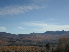
view from Greeley Ponds trail
some peak
Originally uploaded by wereldmuis.
This is a view of a distant peak, taken while traveling along Greeley Ponds trail. I suppose it might be Mt Osceola or East Osceola, but I'm not sure. It was in the right direction for one of those, to the southwest.
I deliberately hiked very slowly, for several reasons. I was not in great condition; I hadn't done so much hiking this year - very little of it with a loaded pack, and most of it more than a month ago. Now, I was carrying a pack weighing about 26 lbs. Sometimes a lot of hillwork can give me knee pain. I wanted to avoid that if at all possible, and going slower seems to help. Also, I wanted to avoid getting blisters in my new boots, if possible. Further, I wanted to dole out my energy use slowly, knowing that between here and Mt Osceola was the most difficult part of the trail.
My new Asolos performed very well. Soon after starting on Greeley Ponds trail, I had to cross a couple of streams that couldn't be managed without stepping into the water a few inches. No leaks! There were pools of water everywhere along the trail, and my feet never got wet.
It took me about 50 minutes of hiking to cover the 1.3 miles of Greeley Ponds trail before it intersects with the Mt. Osceola trail. At this point, I stopped to apply Dr. Scholl's Blister Treatment cushions on some spots where the shoes were rubbing my heels. I've only used these before on actual blisters, but I decided to try them out for blister prevention. In the end I think they worked pretty well, but I still managed to get a blister just outside of the cushion on my left foot. Other than that, no blisters, excellent!
The Plan
greely ponds parking lot uncrowded
Originally uploaded by wereldmuis.
This is a view of the Greeley Ponds parking lot, with signs pointing the way to Greeley Ponds and Mt Osceola. This shot was taken around 9:30 a.m.
It was incredibly quiet there, which was nice; I guess people were scared off by the threat of rain. In fact it had rained on and off during the drive up, but once I got there, it stopped raining, and didn't start again until noon.
I planned to do one night out in the Whites. I had decided on a loop involving Mt Osceola. I would start at Greeley Ponds trail off the Kancamagus Highway, then follow the Mt Osceola trail over the peaks of East Osceola and Mt Osceola, and then loop back either by East Ponds trail to the north, or Greeley Ponds trail to the south, the following day.
Getting to the summit of Mt Osceola from the Kancamagus Highway sounded steep and difficult, but I figured that it would be better to do that first, while I was still relatively fresh. There was a danger that I might decide to bail at some point, which would mean I'd need to turn around and descend it again. I knew that would be really tough, but decided to risk it.
new boots
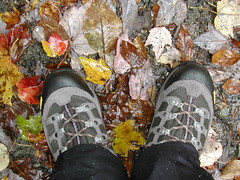
new boots
Originally uploaded by wereldmuis.
These are my new boots, as I stand in the Greeley Ponds parking lot on my first trip to the White Mountains.
One of the reasons I didn't do as much hiking this summer is that my boots, a pair of Lowa Renegade GTXs, are in such bad shape. They're nearly ten years old. They've become leaky with some pretty big holes in the toes. And the soles are worn unevenly; in some places the treads are gone.
I tried to buy a pair of identical-but-new Lowas because I was so happy with their fit and flexibility. While Lowa still makes the Renegade GTX, it seems they have resized them. I bought a new pair, same size as my old, but my orthotics, which were cut to fit my current pair exactly, did not fit into the new boots. And the next size up was far too big.
So I knew I was doomed to have to go shopping for hiking boots, an activity that I dread, and I procrastinated.
It got to the end of the hiking season and I still hadn't gone on a backpacking trip, mostly because of the boots. I had one weekend targeted to go backpacking, so I could procrastinate no longer. I went to REI and EMS, and after much suffering and despair, I finally wound up with a pair of Asolo Styngers. These are about as light as my Lowas (about 2 lbs), and seem to fit me about right (not as well as the Lowas, unfortunately).
I was going to use these boots under non-ideal conditions. I had bought them one week before my backpacking trip, so there was no time to break them in. And I'd be hiking in the Whites, unfamiliar terrain. It would be a good test of the boots!
Saturday, October 03, 2009
Tank ninety-two
Total miles: 33256. Trip miles: 398.8. Gallons: 7.22. Price per gallon: $2.589.
Screen mileage: 53.5 mpg. Tank mileage: 55.2 mpg.
Screen mileage: 53.5 mpg. Tank mileage: 55.2 mpg.
Subscribe to:
Posts (Atom)