Thursday, August 31, 2006

The Twentieth Century: A People's History

I finished "The Twentieth Century: A People's History", by Howard Zinn, just today.

It has taken me forever to get through this book. I am handicapped in having taken a dislike to history from an early age (probably because of the way it was taught). In addition, though, the book is brutal: Zinn relentlessly pounds out a laundry list of horrifying American atrocities, from the beginning of the twentieth century until George W. took the White House. There is no way I could call this book enjoyable. I felt like the guy in Edvard Munch's The Scream every time I finished another chapter.

Despite that, I consider this book extremely important. Everyone should read this, if only to get some balance to the history that was written by the victors. At that, it's only a brief intro to the subject, but it's a good start.

Sunday, August 20, 2006

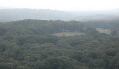
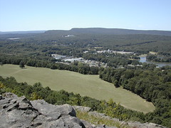
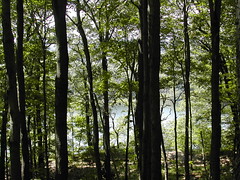
View from York Mtn


View from York Mtn
Originally uploaded by wereldmuis.
Today's hike: 2 h | 3.8 mi | 1.9 mph

I parked at Gaylord Mountain Rd/Westwoods Rd again, and went up the trail to York Mountain, hiking all the way over to Paradise Av. I didn't want to go out too far because there was a potential for thunderstorms, which never materialized. Anyway, it was quite humid, so I wasn't eager to do a long hike.

This photo shows one of the few good views looking out from York Mountain.

Saturday, August 19, 2006

Lake Watrous, New Haven, LI Sound views


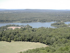
Lake Watrous
Originally uploaded by wereldmuis.
From the cottage, I continued on past the radio tower and giant satellite dishes, skirted a couple of large houses, and finally hit Downs Rd, which is completely overrun with McMansions these days.

Instead of reversing course there, I walked out to Gaylord Mountain Rd, and then followed that south back to my car. I thought that I could use the road as part of a quick loop back to my car, and from there I could then head east on the Q Trail. But hiking Gaylord Mountain Rd back to my car took about 45 minutes, longer than expected.

The road is lightly trafficked and you can see some interesting things along the way - a couple of horse stables, and some lovely houses. I passed a woman in heels crossing the road to bring a bucket of grain and a block of hay to a couple of horses in a corral, which was a little amusing.

I did hike on up the east side of the Quinnipiac Trail to catch the view of Lake Watrous and Long Island Sound. I sat there enjoying the view for a little while, and then headed back to my car. It was a very enjoyable hike.

View of New Haven and LI Sound
Originally uploaded by wereldmuis.

Quinnipiac trail cottage


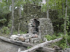
Abandoned cottage
Originally uploaded by wereldmuis.


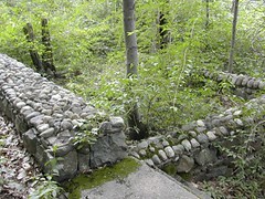
Old walls at the abandoned cottage.

Abandoned cottage


Abandoned cottage
Originally uploaded by wereldmuis.
Today's hike: 2 h 25 min at a leisurely pace

I did part of the Mad Mare's Hill section of the Quinnipiac Trail today, starting in Bethany Gap. There's basically one parking spot there on Gaylord Mountain Rd/Westwoods Rd, and I grabbed it. From there, I hiked northwest to the summit of Mad Mare's Hill (not much of a view).

I stopped at the abandoned cottage off the trail, and took a look around. It's pretty neat. There's an old pipeline (for water?) that runs up here from down the hillside somewhere, and some picturesque old walls that are studded with round stones. The cottage sits on a ridge and might have had a nice view back in the day. I startled a small snake which slithered off into a crack in a wall.

Hot cacao


Hot cacao
Originally uploaded by wereldmuis.
This is the final product. I found that this cacao powder made a smoother paste than Rapunzel cocoa does when mixed with a little milk and sugar.

The flavor is interesting. There's that distinct acidity, but it's not nearly as strong as eating raw cacao beans. Also, there's a bit of a fine powdery texture (not gritty, though) to the drink, as if the grain of the powder is larger than for regular cocoa. It's interesting. I think I'll enjoy finishing off the package, but I don't think I'll be buying this on a regular basis. It's nice for a somewhat exotic change of pace.

Cacao


Cacao
Originally uploaded by wereldmuis.
The Navitas Cacao Powder was a new product that I hadn't seen before. It was undoubtedly the attractive packaging that provoked me to buy, I have to admit it. I've eaten raw cacao beans previously, and they're an acquired taste. To me, they're very acidic - a bit too close to stomach acid to enjoy. Plus this stuff is so much more expensive than the stuff I usually buy to make hot cocoa - Rapunzel Kokoa, which is also a pricey item at $6.50 per 7.1 oz.

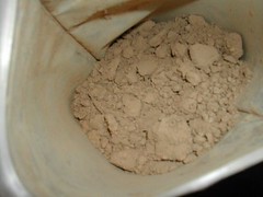
Anyway, I decided to give it a go. Here's what the cacao powder looks like upon opening the bag: it's a lighter color than the Rapunzel cocoa powder. It has that strong acidic cacao smell along with a nice cocoa scent.

Luxury food purchases


Luxury food purchases
Originally uploaded by wereldmuis.
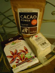
I had a bout of consumeritis at the health food store today. These are a few of my purchases: a pack of Navitas Cacao Powder (8 oz. for $15.35!!!), The Bridge Tofu ($2.19), and a box of Naturally India Simmer Sauce - which was a free sample! The simmer sauce motivated me to buy the tofu, so it was an evil free sample.

Adventures in car repair

A couple of weeks ago, one of my car headlights, a Wagner H6545, went out. I've been putting off taking care of it because I hate wasting time on things like this.

Last weekend I finally made it to Pep Boys. They had a replacement headlight (a Sylvania H4666 IIRC) for $21. When I went to the aisle to get one, I found that the two lights in stock had had their boxes opened. On one, the connectors in back were bent. Irritated, I decided not to buy.

Later in the week, I went to a nearby independent auto parts dealer, the type of place where you tell them the part you need, they look it up, and bring it to you from aisles and aisles of stuff in the back. Here, it was a GE H4666. Unit price: $9.29. List price: $17.94. Presumably the latter is what I'd be charged for the part if I had the repair done at my mechanic's. The first time I bought this light, years ago, I got it from a dealer for $35! I rubbed my hands in glee over the savings, even compared to Pep Boys.

Since it's forbidden to do car work in the parking lot of my apartment complex (raspberries to the management), I went to work this morning to do the job there. There are loads of tools at work, so I figured I'd grab something there if my screwdrivers didn't fit. When I arrived, I saw that one of my coworkers was at the office. In one sense that was good timing, it was one of the guys who does hardware work. In another way, it was bad timing because I deliberately wanted to do the work on Saturday with no one around.

When it turned out that the screws for the light were rusty and stuck, I asked said coworker if we had something to loosen the screws; he got me some WD-40 and instantly volunteered to help. I like doing little repairs like this, but I know from past experience that the headlights on my car can be a real pain, so I agreed. He got out his torque screwdrivers and did the whole job while I looked on. I appreciate his help, but it had the side effect of making me feel like a weak damsel-in-distress. Damn, I hate that!

Wednesday, August 16, 2006

How to raise a feminist

Over at Moderately Insane, sailorman wonders how he can raise his children to be feminists.

This is my reason number 336 not to have children: the fear that, despite my best efforts to program them to be what I want, they will turn into something horrifically (or maybe only slightly) disappointing, so much so that I wouldn't be able to love them. I mean, what if I raised an Ann Coulter or a Ted Bundy? I know I wouldn't be able to bear it.

Is it actually possible to program your kid to be a feminist? Or more nicely put, to cultivate feminism in him or her?

My sister-in-law recently sent out photos of my 7-year-old niece's birthday party. It was a party of about 15 girls; I didn't see a single boy in the photos. One of the major activities was to play at applying cosmetics to their faces.

So I'm flipping through the photos and my immediate, visceral reaction is "what is this sexist crap!!". I can't just look at the photos and see a bunch of happy kids playing. Instead my hair is standing on end, wondering just how my niece is being socially programmed. I can only hope that she'll rebel against it all in her teens.

But do experiences like that really have anything to do with how my niece feels about herself as a female person? Will she be less inclined towards feminism as a result? I have no idea. Something tells me it doesn't matter at all.

Tuesday, August 15, 2006

Donkey Skin

Last week I watched the movie Donkey Skin (Peau d’âne). A ring – une bague – plays a prominent role in the story. So here’s a question: why does “bague” mean “ring” in French but “baguette” means “stick of bread”? Are the two words related at all? Very strange. Much like the movie, which is a bit trippy.

Sunday, August 13, 2006

Lamentation view

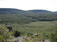
Another nice view of the Metacomet range, from the top of Lamentation Mountain.

Lamentation view


Silver Lake


Silver Lake
Originally uploaded by wereldmuis.
This is the view from Lamentation looking out to the west of where the USGS survey marker is located. That's Silver Lake down below. There's a nice panoramic ridge view when you reach the top of Lamentation.

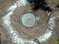
USGS marker


USGS marker
Originally uploaded by wereldmuis.
The marker reads "U.S. COAST & GEODETIC SURVEY ... AND STATE ... ELEV... LAMENTATION ... FEET". Someone(s) has been chiseling at it - which is, ya know, illegal! - it's illegible in places. This would appear to mark the peak, but if you walk on a short bit, I think you come to the highest point on Lamentation.

Quarry


Quarry
Originally uploaded by wereldmuis.
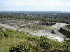
This is a closer view of the quarry that I saw in the distance during yesterday's hike. It's the York Hill Trap Rock Quarry, run by L. Suzio (not Tilcon as I guessed yesterday).

Cosmopolitan Club


Cosmopolitan Club
Originally uploaded by wereldmuis.
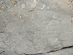
There are numerous engravings in the flat trap rock at the top of Chauncey Peak along the blue trail. I guess it makes a very tempting surface for carving.

This one says something like "Cosmopolitan Club June 20 1875". I wonder if this was really carved in 1875. There are other engravings (somewhat illegible so I'm guessing here) - "Frank Studinst 1935", "Reuben Roo 1800", "Joseph Hill 1812". I wish I knew the history of these engravings.

View of Mt Higby from Chauncey Peak

This is another view from Chauncey Peak, looking out to the southeast. That's where I hiked yesterday, Mt Higby. The power lines that were in some of my photos yesterday are clearly visible.

View of Giuffrida parking lot from Chauncey Peak

Today's hike: 2 h 50 min | 4.2 mi | 1.5 mph

I did the section of the Mattabesett from Giuffrida Park to Lamentation Mountain. I've done this section once before, in September of 2004. I think the hike up to Chauncey Peak from the dam at Giuffrida is the toughest that I've experienced in Connecticut to date. Today, it took me about 20 minutes. It's very steep and covered in small, loose rocks that make the footing treacherous.

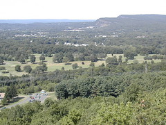
This is a photo taken from Chauncey Peak. In the lower left corner you can see the parking lot at Giuffrida Park. The reservoir is to the right, but obscured by trees. In the upper right corner, off in the distance, you can see the Metacomet range. If you zoom in close you can even see Castle Craig.

Saturday, August 12, 2006

Steep drop


Steep drop
Originally uploaded by wereldmuis.
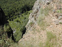
The trail is not especially difficult or dangerous, but it does take you past some pretty steep drops, right off the trail, like this one. Last week, a girl died after falling from this trail: "she fell some 200 feet off a large cliff in Middlefield. She and her friends had just hiked the trails of Mount Higby... Rescue workers had a tough time trying to reach the 17-year-old. A state police helicopter was used to help find her but rescue workers had to carry her out by foot."

Be careful out there, people!

The trail


The trail
Originally uploaded by wereldmuis.
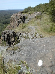
This is a view of the trail on the way back.

I made it all the way down to Guida's (at the intersection of Routes 66 and 147) at the south end.

There's a new parking area off of Route 66, so you don't have to park at Guida's anymore if you start at the south end. The parking area is about half a mile west of Guida's on the north side of Route 66. There's a red-blue blazed side trail that connects the parking area with the blue trail here. I was astounded because the parking area is paved and even has painted parking lines! There are about eight spaces, and one of them is a handicapped spot, which struck me as kind of ironic.

When I got to Guida's, I really really wanted to get one of their hotdogs. But it looked horribly crowded, so I just headed back.

I should mention that you can get a couple of glimpses of Black Pond to the south of the trail, between the new parking lot and the ascent to Mt Higby. Views of the pond are largely obscured by trees.

Natural bridge


Natural bridge
Originally uploaded by wereldmuis.
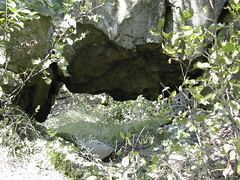
I was up on the ridge, checking out this natural bridge from the cliffside, when a large dark snake slithered into a crack in the rocks near my feet. It gave me quite a shock! You don't want a surprise like that when you're standing at the edge of a cliff!

Quarry


Quarry
Originally uploaded by wereldmuis.
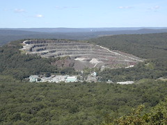
When you get to the ridge there's a pretty nice panoramic view for a nice length of the hike. First thing you see is a large quarry operation. I want to take a guess and say that it's run by Tilcon, but I'm not sure. [Edit: On Sunday, I discovered that the quarry is not owned by Tilcon, but by L. Suzio.]

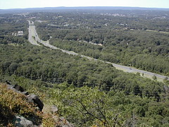
View of Route 91 from the trail

After about 2 miles of hiking, the trail begins to rise as you approach Mt Higby. The trail turns into a ridge walk that follows Route 91. You know you're approaching it when you hear the rather loud traffic noise.

One thing that's nice about this section is that the trail is level to start with, whether you approach it from Guida's at the south end or Country Club Rd from the north. This gives you a chance to warm up before doing any climbs. The climbs are not very steep or difficult, either.

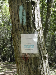
Blue and white striped tape


Blue and white striped tape
Originally uploaded by wereldmuis.
After about 5 minutes' hike into the woods, I came to a sign that said the trail was marked with blue-and-white striped tape from there until the road, back the way I came. That would explain the lack of blue blazes! It would be helpful if they posted this sign at the start of the trail, too! Or not; there were only a few taped trees, anyway.

The first two miles of trail meander as if they were blazed by a drunken or crazed person. There's a lot of blowdown, and the trail seems to be all broken up. You have to be careful not to lose the trail since there are dirt roads that criss-cross the area. I passed some off-road bikes and ATVs in this area on the way out. Since I'm paranoid, I melted into the woods when I heard them coming.

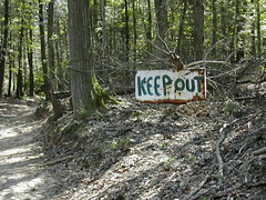
Keep Out


Keep Out
Originally uploaded by wereldmuis.
Once you enter the woods, it's confusing unless you know where to go - no blazes in sight, aside from the first ones marking the turn-off. I just walked up the woods road, and hoped I'd eventually find blazes. I passed a couple of "Keep Out" signs. Very friendly! Beyond the signs you could see old tires scattered about in the woods.

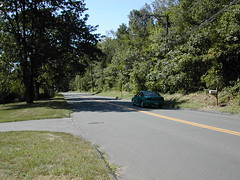
Country Club Rd


Country Club Rd
Originally uploaded by wereldmuis.
Today's hike: 4 h 25 min | 8.6 mi | 2 mph.

I did the Mount Higby section of the Mattabesett. Lotta people out there today. Nice weather: cool, breezy, sunny.

I've done this section before. This time I hiked it in the opposite direction, going south. I took Rte 91 to exit 20, turned right onto Country Club Rd, and then zagged an immediate left onto an unmarked road. That is "Miner Rd" according to the map, but there was no sign - well, aside from the "Public Golf Course" sign. Almost immediately you get to the dirt shoulder where you can park - lots of trees for all-day shade, very nice!

From the dirt parking area, you walk about 5 minutes going east along Country Club Rd to get to the turn-off going south into the woods. It's not a bad walk: speed limit is 25 mph and there's a grassy shoulder the entire way. The turn-off is a little difficult to recognize. It's almost opposite house number 666 (really!).

This photo gives you an idea of the walk along Country Club Rd. No danger.

Sunday, August 06, 2006

Pistapaug Mountain


Paug and Trimountain
Originally uploaded by wereldmuis.
I did a 2-hour hike on the Paug and Trimountain section (mostly Pistapaug Mountain) of the Mattabesett today; about 5 miles round-trip, starting from Rt 17.

Nice and sunny, hot but bearable.

This view is of Pistapaug Pond. It's the first view you get of the pond, coming up off Rt 17; about 20 minutes in.

Friday, August 04, 2006

A day of culture


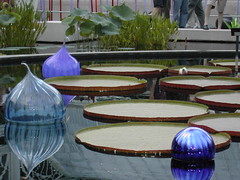
Chihuly blue floats
Originally uploaded by wereldmuis.
I visited MoMA this morning (actually, Thursday morning...) for the Dada exhibit, and the Chihuly exhibit at the New York Botanical Garden this evening (complete with Jazz ensemble).

I highly recommend Terrace 5 at MoMA for lunch, especially if there's room to dine outside, overlooking the outdoor sculpture garden. Fantastic service, mouth-watering food (in particular, the chilled cucumber soup). I visited MoMA with two wheelchair-users, and all of the staff that we encountered were notably accomodating, friendly, and gracious.

Delightful day!