For my latest hike, I did the Beseck section of the Mattabesett trail, from Rt 68 to 66 and back. It took me 4.75 hours to cover the approximately 12-mile round trip, making my pace about 2.5 mph. I hadn't intended to do the whole section, so I had insufficient food and water. I have difficulty resisting the urge to complete a section once I get on it.
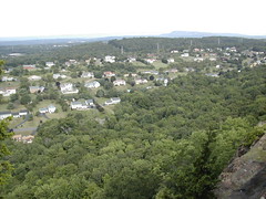
This section of the Mattabesett is a nice cliff walk. It would be nicer if it weren't for the fact that the views are mostly of suburban subdivisions. Unfortunately, for most of the trail you get the constant raucous noise of suburbia - traffic, engines, especially lawn mowers, and loud-speakers near some resort area. Connecticut trails!
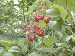
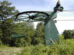
This particular section of the Mattabesett is poorly described in the Connecticut Walk Book. There are a few items of interest. There's a section in the middle where raspberry bushes are growing right next to the trail. Delicious and plentiful - I came upon them at just the right part of the season, it seems. After this, you come to a small ski area that appears to be entirely defunct. I know that the Powder Ridge ski area is in the vicinity, but I don't think there's a connection with this one. There are just a few chair lifts that end where the blue trail crosses the cliff. Looking down to the east from here, you can see the small pond that must have once fed the snow-blowers that still sit, rusting away.
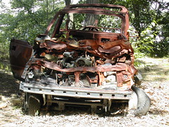
Beyond the ski area you come to an overlook populated by three car wrecks. It must have been an interesting drive getting those cars up there. I wonder what the story is there.
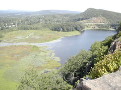
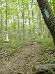
Farther on, you come to several nice views of Black Pond (although this section is called Beseck, I never saw a view of Beseck Lake, which is off to the east). After a while, the trail curves away from the cliff as it leads to Rt 66. There's an old chimney just to one side of the trail in here. I have to wonder what the story is there, as well. Was there really a house here, once? Trail conditions from this area to Rt 66 are poor. At some point there's so much blowdown that you really have to take care not to get off-trail.
I picked up a couple of ticks near Rt 66. They were large; either adult deer ticks or wood ticks. Fortunately I noticed them in time and removed them before they had latched on. The insect population on the trails seems excessive this year. I'm frequently pestered by deer flies, which haven't been a problem in past years. Maybe it's the excessive heat and humidity this year.
Population on the trail was slim. I passed an old fellow with a straggly white beard, looking a bit like a Buddha, sitting with his dog at a view point along the cliffs. On my return, I passed two people picking raspberries. Other than that, no one. You might think it's the weather that's been keeping people off the trails, but in my experience CT trails are just generally dead, aside from major holidays. This may or may not be fortunate. I like the solitude but I think the trails are in major danger due to lack of use. Probably 100 years from now there will be no trails left, they will all be plastered over with pavement, subdivisions, and lawn mowers.
On the way out, I tried to avoid the hairy 0.2-mile walk along Rt 68 to my car by leaving the blue trail early and following the railroad tracks. Following the tracks seems a little risky, I don't know how bad it would be if a train passed by. And there's no great exit from the tracks onto Rt 157, which passes under the tracks. Rt 157 doesn't have any more space for walking than Rt 68 does, but it's much less trafficked. Can't believe they put the blue trail blazes along that stretch of 68, but I guess they had no other option.