Sunday, September 24, 2017

Mt Monroe

Today's hike: 6 mi | 5 h |  1.2 mph

Today, I hiked up to Mt. Monroe, my 22nd 4000-footer.

someone left a pair of boots at the side of the trail!
The mountains in the Presidential Range are some of the taller 4000-footers, and I've been expecting the hikes to these peaks to be more difficult than my previous 4000-footers. However, this did not turn out to be the case. It's not an easy hike, but nothing to be intimidated by.

I took the Ammonoosuc Ravine Trail. Mt. Monroe is 5,372 ft high. The elevation gain for this hike is about 2,800 ft. The only real difficulty that I encountered was that the trail has some steep, slabby sections, and they were often wet. This was true despite the fact that it hasn't rained in several days. The wet areas were made extra slippery by a thin layer of dirt and sand, and I did slip a couple of times. I used my hands to help secure my position, here and there, along the way. I would not want to be on this trail soon after a rain, or while it was raining. The White Mountain Guide book recommends this as the best trail for getting to the AMC hut up near Mt Washington in bad weather, because it is in the woods most of the way. No thanks!
cascades at about 2.3 miles into the Ammonoosuc Trail
It was a warm fall day. It's early yet, and the trail only had a light sprinkling of autumn leaves. It being Sunday, the trail was fairly busy. I lost count of the number of hikers that I passed or who passed me; perhaps there were about 20 groups in total. This was far too much traffic for my liking, but other than that, it was a nearly ideal day for the hike.

After about 3 miles of hiking, you break through the trees, and the ascent becomes much less steep, hence easier. However, I still had to be careful ascending some wet slabby areas.
Ammonoosuc Ravine Trail on the approach to Lake of the Clouds AMC hut
It was not long before I got a glimpse of the "Lake of the Clouds" AMC hut. I'd read reports that it was not open after September 16. It was, indeed, boarded up.

At this point, my goal was clearly in sight - Mt. Monroe was a short, easy hike from the hut. Up until now, the day had been quiet and cool. As I ascended Mt. Monroe, the wind picked up, and I had to hang onto my hat for fear of losing it. Next time, I should remember to bring a keeper of some sort for the hat!
closing in on Mt. Monroe
Mt. Washington is in plain view once you get to the "Lake of the Clouds." Looking at it from Mt. Monroe, I was sorely tempted to head up there, and bag another 4000-footer. However, I decided against it. It will probably be more fun (i.e. less crowded) to hike there on a weekday, and I'm not in a rush.
Mt. Washington and the Lake of the Clouds as seen from Mt. Monroe

Thursday, August 17, 2017

Mt Whiteface

Today's hike: 8.4 mi | 5.5 h | 1.5 mph

Today I hiked Mt Whiteface, my 21st 4000-footer! I went up via the Blueberry Ledge Trail, and returned the same way. According to the AMC White Mountain Guide, the Ferncroft parking lot where the hike starts is at 1,140 ft above sea level. Mt Whiteface is 4,019 ft tall, so the elevation change was 2979 ft. It didn't seem so steep, though.

It's a straightforward hike, but it is misleading to start. The trail is pretty flat for about the first mile, then trends up and eventually takes you over numerous stairs constructed from stone. Just when you are wondering whether you are really in the White Mountains, because this seems far too easy, you come to a sloping ledge with a steep drop-off. After circumventing that, the trail goes up several slabs and ledges that call for some rock-climbing moves (I needed my hands to get up the trail several times). It's fun, but I wouldn't want to do it in the rain.

This is a view of one of the steeper slabs, higher up on Whiteface. If you zoom in, you'll see pairs of holes running up diagonally to the right. Perhaps there was once a wooden ladder here. I went up this area at the far left. It's a slippery slope down at the bottom; I used the dead tree stump to pull myself up.
steep slab on Mt Whiteface

Tuesday, February 07, 2017

peaked mountain

Today's hike: 4.0 mi | 2 h | 2 mph

It snowed on and off during this hike. The trail had a light coating of 1-2 inches of snow. I climbed up the Middle Mountain Trail to about 1/2 mile below Middle Mountain, then took the Peaked Mountain Connector Trail to the top of Peaked Mountain. I descended via the Peaked Mountain Trail, which makes a nice loop.

The footing was not bad. Microspikes were sufficient. Snowshoes would have been overkill.

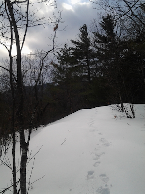
There was no sign that anyone had been out this morning. On the way back, I saw cross country ski tracks heading towards the Pudding Pond Trail. I also saw fresh turkey tracks crossing the Middle Mountain Trail and the Peaked Mountain Trail. I think it must have been the same flock of about 6 or 7 turkeys.

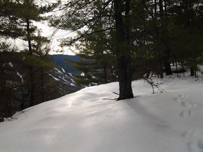
View from the top of Peaked Mountain this morning

Saturday, February 04, 2017

boulder loop trail

Today's hike: 2.8 mi | 1.5 h | 1.9 mph

Went clockwise around the Boulder Loop Trail. This area is very nice, going through a few areas that are quiet and filled with big pines. It was kind of busy due to it being Saturday.

View of the Swift River and ledges beyond from the Covered Bridge at the parking area

Saturday, January 28, 2017

a hike to the summit of White Ledge

Today's hike: 2 h | 3.4 mi | 1.7 mph with an elevation gain of about 1400 feet.

I hiked to the summit of White Ledge in Albany, NH, starting from the White Ledge campground. The gate is closed, but parking is possible just off the road. The trail is still completely covered in snow, and it's pretty deep, at least a foot in most places.

I used my Kahtoola microspikes the entire way. Some form of traction is really necessary, imho. The snow has a pretty good crust on top, so post-holing is rare. You are more likely to slip on the icy crust, instead. I'm guessing, but I think the trail is pretty solid because of previous hikers who have been along here and compressed the snow in the weeks past. I saw just one set of tracks on the trail, and met someone coming down off the mountain about halfway up. I suspect the trail is pretty well used in the winter, though.

Near the summit, the snow got a lot softer and I wound up post-holing more frequently. I would have been glad to have snowshoes, but the idea of bringing them all that way just to use them near the top seems silly.

The weather was pretty good on the way up, with some blue skies, and the sun peaking through clouds. The clouds thickened up as I reached the summit, and a few flakes of snow came floating down, resulting in a rather gloomy descent.

Here's a note for naturalists: I saw lots of snow fleas along the trail. It did warm up into the 40s this week, and today it was in the mid-30s. The snow fleas seemed to want to congregate in the boot holes left by the person in front of me... Interesting, I have no idea why.

Coming down off the summit of White Ledge

Saturday, January 14, 2017

Mt Stanton

Today, I hiked up the Mount Stanton Trail, to the summit of Mt Stanton. The round trip distance was 3 miles, with an elevation gain of 1000 feet. It took a total of 2 hours, averaging 1.5 mph. This was very good, considering the trail conditions were pretty icy. I wore Kahtoola MICROspikes. I wouldn't have wanted to hike this trail without them, especially the steep bits.

It was below 20ºF, but it wasn't windy at all. Once I got started, I warmed up pretty quickly.

view of Attatash on the way to the summit of Mt Stanton
The trail conditions are packed ice and snow. I doubt you'll have fun if you don't bring some form of traction. Snowshoes are not a good choice here. A woman was coming down carrying snowshoes. She had removed them, and was using Yaktrax. She said she'd more or less slid down the steep parts of the trail above, but she hadn't wanted to use the snowshoes on the way down. Yaktrax are not really meant for steep terrain like this, though.

Despite the chill, and the clouds, it was a fun hike! The sun did peak through the clouds once in a while. I haven't done much winter hiking, but so far it seems straightforward.

Wednesday, January 11, 2017

snowshoeing up Middle Mountain Trail

Last night, it got unseasonably warm. Snow turned to rain. And then the skies cleared, and we got a beautiful, pleasant day for a change.

I went hiking up Middle Mountain Trail, where I've been snowshoeing before. The trail is pretty beaten down, and the rain has made the snow soft and a bit slushy. I started out without traction, then put on snowshoes as the trail steepened. This kind of snow might be best traversed with snowshoes rather than microspikes. With the latter, you may still be sliding on slippery snow.

view on the way up Middle Mountain Trail
The only difficulty I encountered was a significant ice bulge that covered the trail, about a mile in:
ice bulge covers the trail
Everyone seems to go right. You can grab the trees. I also grabbed an ice pocket down at the bottom. This is a steep section, so you don't want to lose your footing here. This was the only difficult part to the trail.

I hiked up to the intersection where you meet the Peaked Mountain Trail, then turned around. It's a half mile to Peaked Mountain from here, and 0.8 miles to Middle Mountain. Some other day...
Peaked Mountain - Middle Mountain Trail Connector
It doesn't get much better than this! Hiking back down was a lot easier than hiking up. 
View on the way down Middle Mountain Trail
The hike was a total of 2.4 miles. It took about an hour and 25 minutes, for a pace of about 1.7 mph.