Friday, August 21, 2009
Tank eighty-seven
Screen mileage: 57.9 mpg. Tank mileage: 58.1 mpg.
Longer drives. The weather has been exceptionally warm.
Saturday, August 15, 2009
scary computer incident
Thursday night, as the computer was shutting down, I realized I had forgotten to remove a DVD. I hit the eject button before the machine finished shutting down, and managed to get the DVD out in time.
Next morning, I turned on my PC, only to be greeted with a horrible high-pitched whining noise. At first I thought the sound was coming from outside. Then I realized it was coming from inside, and in fact was coming from the computer. The boot process had stopped progressing with the monitor displaying "www.dell.com" up at the top (probably not the kind of thing that Dell wants engraved in my mind).
I tried rebooting several times and had no joy. I did some surfing on my laptop to look for the cause. Amazingly, I could find no answers to the few existing questions about a Dell XPS 400 failing to boot with a nasty high-pitched whine. I found the Dell support page describing beep codes and diagnostic lights. None of the "1 2 3 4" lights were on in my case, so that was useless. In addition, I was clearly not getting a beep code. I suppose it's possible that the weird high-pitched whine was a manic non-stop beeping, but there's no error code for that.
I found a discussion that said to hit F12 when the computer starts up, to run diagnostic tests, but no description of what use that might be. Anyway, I tried it.
After hitting F12, you get a menu of options. I tried the hard drive diagnostics, and got this output:
Hard Drive Diagnostics running, please wait...That was hopeful; the hard drives (the ones passing) looked OK, at least.
Drive 0: WDC WD1600JS-75NCB3 - Pass
Drive 1: No device
Drive 2: WDC WD1600JS-75NCB3 - Pass
Drive 3: No device
Drive 4: HL-DT-STDVD-ROM CDR8164B - Diagnostics not supported
Drive 5: PHILIPS DVD+/-RW DVD8801 - Diagnostics not supported
I tried another diagnostic and noticed the following boot sequence description:
Boot SequenceHm, OK.
1. Onboard or USB Floppy Drive
2. Onboard SATA Hard Drive (not present)
3. Onboard IDE Hard Drive (not present)
4. Intel ARRAY
5. Onboard or USB CD-ROM Drive
One of the other options from the "diagnostics" screen read "Intel ARRAY". I decided to try that. Surprise! Choosing "Intel ARRAY" from the diagnostics list caused the machine to boot in a healthy fashion. Apparently that option is actually not a diagnostic test.
Leaving the computer on, I immediately rushed off to Staples to pick up some CD-ROMs to do a thorough back up of all my files, since I've become really negligent about backing things up over the last year (you'd think I would learn, but no). At least I remembered to back up my Desktop items and my Firefox profile this time.
I suppose it's possible that the machine was trying to boot from the empty DVD slot, but the failure seems completely insane to me. It makes me worried that something more severe is going on with my computer, and that perhaps the end is near.
blue hills view
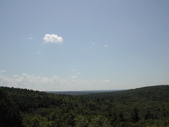
blue hills view
Originally uploaded by wereldmuis.
I hiked for 3 h 20 min at Blue Hills Reservation today. I carried a pack weighing about 14 lbs.
It was unexpectedly crowded. And blisteringly hot at 90 °F. I was feeling tired and mostly slogged along.
Sunday, August 09, 2009
smiling rock
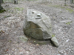
smile
Originally uploaded by wereldmuis.
I came across this smiling rock while hiking at Blue Hills Reservation today. Cute!
graffiti art

graffiti art
Originally uploaded by wereldmuis.
Today I hiked for 2.75 hours, about 5 miles at Blue Hills Reservation. I hadn't seen this graffiti art before. It can be found along Accord Path. Weird, interesting! What does it mean?
view from pratt
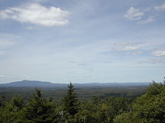
view from pratt
Originally uploaded by wereldmuis.
Soon after passing Binney Pond, I came to signs for a spring, and from then on it was uphill all the way. I was hoping I would make it to the top of whatever I was climbing before having to turn back.
Up till this point I hadn't met anyone since the trail runner at Watatic. But lo and behold, coming down the trail at me was the same trail runner! He said "hello again!" and passed on, sprinting down the trail like a deer. He had done the two peaks, just as I was doing. I wonder where he started?
Soon after this, I reached the summit of what turned out to be Pratt Mountain. There's a nice view here of an intriguing mountain to the NW. It looked sort of bald on top. There's also an overlook of Binney Pond, which I avoided because it was occupied with a small crowd of people. I'll have to come back for that some day.
From there, I pretty much retraced my route, although I did avoid the "detour" to the north of Watatic and stayed on the Midstate Trail on the way back. The trip out took me 3 hours, while the trip back took only 2.
On the Midstate Trail south of the MA state line I ran into a couple of really big ATVs, which was incredibly annoying. This kind of traffic is really aggravating on the trail, and I don't know if it's legal. Other than that, it was a very nice day for a hike. Cooler than normal for this time of year, and the bugs were still pretty quiet. Nice!
binney pond

binney pond
Originally uploaded by wereldmuis.
I don't yet have a map for the Wapack Trail. I'm still debating whether I really want one, since the trail is only about 20 miles along.
From the N.H. line, I knew I just had to follow yellow triangles to continue on the Wapack Trail from the Midstate Trail. Not having a map, I had no idea what to expect of the trail other than that. Eventually, I crossed into Binney Pond State Forest. This is a view of said pond.
It's a huge pond.
midstate trail end

midstate trail end
Originally uploaded by wereldmuis.
This is another terminus marker for the Midstate Trail, alongside the first one. It looks like it would make a nice bench, but I didn't try it.
It reads:
MIDSTATE TRAIL
N.H. 1985 R.I.
midstate trail end

midstate trail end
Originally uploaded by wereldmuis.
I hiked rapidly down from Watatic on a gravel trail - so rapidly that I missed the turn off into the woods. (Coming back, I didn't see a clear blaze pointing the way, either).
Heading down, I saw a trail runner coming up the gravel track. We gave each other a smile as we passed each other. Trail running looks fun, but strikes me as too risky. I have a tendency towards sprained ankles.
In any case, before long I was certain I had missed my turn off. I came to the bottom of the gravel trail, where I found another giant granite monument to Watatic from the year 2000 (there's also a smaller one at the top). The whole place down there looks strangely abandoned, with a giant concrete foundation bordering on some wide open space, and some phone wires running over the ground. In fact it felt a bit creepy.
I had two choices - I could head back up to Watatic and look for the Midstate cut off, or I could look for a trail heading west. I decided on the latter. I found a poorly maintained track which crossed a brook, went up some hills, meandered around. But I finally made it to the Midstate. I'm not entirely sure that I was on public land all the way, hm.
From there, I easily made it to the New Hampshire state line. I found the same marker that I found last year, which reads "Borden 1834". Since I wasn't so tired, I had the energy and common sense to follow the wall a little further west, and found this post which reads "A & A MASS 1894". Is this really from 1894? Very cool!
I was delighted to have found this marker, which I missed last year!
view from watatic
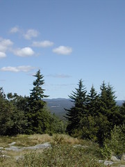
view from watatic
Originally uploaded by wereldmuis.
Yesterday's hike: 5 h 0 min | 10 mi | 2 mph
Mileage is approximate, and I'm probably overestimating; I didn't have a trail map. I did a section of the Midstate and connected with the Wapack, carrying a pack that weighed 14 lbs to start.
I began at the Ashburnham State Forest parking lot, which was pretty crowded. The hike over Watatic to the NH state line is supposed to be 1.06 miles, according to the trail guide. It always takes me an hour. It was 38 minutes from the parking lot to the summit, which is about 400 feet or so uphill, and I'm nearly certain that's how long it took me last year. This year I was much more fresh, but I was also taking my time.
This is a view from the top of Watatic. I looked around, but I could not find the geodetic survey marker that I found last year. Very strange. There were a few people up there, so I didn't stay long.
Monday, August 03, 2009
deer

deer
Originally uploaded by wereldmuis.
I was surprised to come across three deer along the pipeline trail, on the way back to my car. One seemed to be a fawn, and it's not in this photo because it had already scampered into the woods on the left.
The other two were relatively bold. They seemed more curious than afraid. They moved off into the woods as I approached, but didn't go far. I made cooing baby noises at them, and they stared at me.
skyline view

skyline view
Originally uploaded by wereldmuis.
This is a view of Boston from Chickatawbut, yesterday. It was cloudy, hot. But hikable. Nice and quiet, too.
very nice

very nice
Originally uploaded by wereldmuis.
I went hiking for about 2.5 hours at Blue Hills Reservation yesterday. Mostly I meandered around the eastern section, trying to follow trails that I haven't been on before.
At some point I noticed a thin track going uphill and followed it. It was mostly marked with faded purple and yellow blazes, but sometimes I'd suddenly come across a bright green circle like the one in this photo. Garish, but clear!
I stopped here to sit down, and it felt so incredibly peaceful that I was reluctant to get up again. This was a great spot, and I will have to come back soon.
Saturday, August 01, 2009
birthday celebration in progress

consuming the cupcake
Originally uploaded by wereldmuis.
It was an excellent birthday party! The treats were delicious and the view, harmonious. Happy Birthday, A!
birthday candle

birthday candle
Originally uploaded by wereldmuis.
I decided to do the birthday celebration atop Crow Hill Ledges. I managed to get the birthday candle lit, with some difficulty, due to a mild breeze. I didn't even get to finish the birthday song before the wind blew out this flame!
I got to a late start, but it was still morning, so I brought a birthday latte with me. In addition, I picked up a birthday lottery ticket, which promptly refunded the $2 that I spent on it.
crow hill ledges
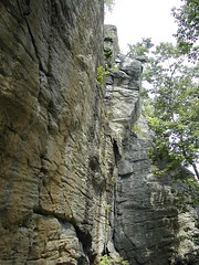
crow hill ledges
Originally uploaded by wereldmuis.
It's that time of the year again. My friend's birthday was yesterday, but I didn't have time for the celebratory birthday hike until today. I went out to the Midstate Trail and did a hike up to Crow Hill Ledges. It was pretty hot, and strangely quiet - no climbers.
Tank eighty-six
Screen mileage: 53.4 mpg. Tank mileage: 52.2 mpg.
Mix of short commutes and longer drives of about 30 minutes or so.