Sunday, June 27, 2010

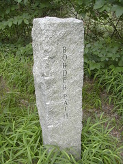
border path


border path marker
Originally uploaded by wereldmuis.

I forgot to mention that there were practically no bugs out today... I did run into a few mosquitoes around Border Path, which runs right next to a small stream for a time. Other than that, bug-free! Didn't get any ticks, so far as I can tell, either.

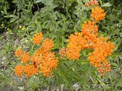
wasp on butterfly weed


butterfly weed wasp
Originally uploaded by wereldmuis.


It took me about 2 h 10 min to get to Rte 28. I had hoped for a 4 hour hike, and it looked like I could do that, but I decided to take an easy, relatively flat route back. I took Forest Path and then veered off on Border Path, a trail I haven't taken before. The disadvantage of this route is that it's closer to traffic, so you get car noise. Still, it's pretty. I saw a whole load of wild flowers in a meadow on a hill - this butterfly weed was especially beautiful.

The trip back was pretty easy, and I went fast. I got back to the parking lot at 3 h 40 min. I still wanted to do a 4 h hike, and I had plenty of energy left, so I revisited the red trail to Summit Rd, and then came back down again. That put me in at exactly 4 h. Wonderful day!

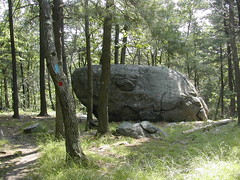
big rock on skyline trail


big rock
Originally uploaded by wereldmuis.


Today's Hike: 4 h | 7.5 mi | 1.9 mph

Mileage is approximate.

Something was going on at Blue Hills this morning. The lower parking lot off Rte 138, where the Skyline Trail crosses the road, was jam packed - turns out it was a half-marathon going on through the park.

I avoided the hubbub by driving further up to the parking lot near the Trailside Museum. From there I went up the red dot trail to Eliot Tower. This part of the hike was a little crowded; seems this is a popular hike for kids. At that point I turned onto the Skyline Trail, and from then on things were pretty quiet.

It was my plan to do a slightly longer training hike today. I wasn't feeling great; I woke up with a slight headache. So I decided to wing it and see how far I could go.

As evidence of my foggy state, I accidentally turned off the trail while unfocused, then turned around and backtracked for a short while. I soon realized I was going the wrong way, fortunately!

After about 1.5 hours, I made it to Headquarters Path. This took about 15 minutes longer than it did last week. Not surprising, since I was carrying a couple lbs more in my pack, as part of the training exercise.

At the Path I saw a load of people wearing orange shirts jogging along the road - and there were no cars in the parking lots. At this point I realized the roads must be closed, which explained why most of the trails were less crowded than usual.

After that, I actually started to feel a little better, and began to enjoy the hike immensely. I must have been loaded up with endorphins. I decided to try to hike all the way to Rte 28, and managed to do this without any problems.

Sunday, June 20, 2010

skyline trail east of rt 138


skyline trail east of rt 138
Originally uploaded by wereldmuis.


Today's hike: 3 h | 5 mi | 1.6 mph

Mileage is highly approximate, since I'm not sure exactly where I turned back.

I started out at around 8 am at the Rt 138 parking lot, right where the Skyline Trail crosses the road. I followed the north section of the Skyline Trail. It took about 1.25 h to get to Headquarters Path. I crossed that and kept walking, turning around about 15 minutes later. There were practically no bugs around (did they spray or something?) but a good number of people out, as usual. The Skyline Trail is pretty popular.

The plan was to do a solid 3 h training hike, and it went well. I carried a backpack, but it wasn't heavily loaded. My feet hardly bothered me at all; no blisters. I'm guessing I climbed 1000 feet or so, going up and down all the small hills along that route. My knees didn't bother me at all, and I maintained pretty good energy up till about 2.5 hours, when the humidity started to get to me.

This is where I get a hankering for a GPS device so I'd know exactly how much mileage I put in, my pace, and the elevation change.

I feel like I'm behind schedule a bit. Last June at this point I'd already done a 4-hour hike. In 2008, by this time, I was already up to 6 hours. *Sigh!*

Saturday, June 19, 2010

Tank one hundred and twenty-seven

Total miles: 44686. Trip miles: 352.0. Gallons: 6.820. Price per gallon: $2.749.

Screen mileage: 55.4 mpg. Tank mileage: 51.6 mpg.

Mostly two long drives.

Tuesday, June 15, 2010

Tank one hundred and twenty-six

Total miles: 44334. Trip miles: 305.8. Gallons: 6.157. Price per gallon: $2.749.

Screen mileage: 54.4 mpg. Tank mileage: 49.7 mpg.

Back to a mix of longer drives and short commutes. Weather's nice and warm which helps.

When I pulled up to the gas pump, the price listed on the sign was $2.799/gal, but the little digital meter listed $2.749/gal, and there was some text about using your Stop-n-Shop card for a discount. I think the previous person must have swiped their Stop-n-Shop card, leaving the discount for me (by accident or on purpose, I don't know). Anyway, it was a pleasant surprise even if it didn't amount to much in savings.

Saturday, June 12, 2010

threatening to rain


threatening to rain
Originally uploaded by wereldmuis.


Today's hike: 3 h | 6 mi | 2 mph

I took another hike at Blue Hills Reservation today. On the way out, I took the Skyline Trail from Rt 28 to the parking lot at Wampatuck Rd. I returned via the easier Green Dot Trail to the pipeline trail on the way back.

Starting out, the weather was pretty reasonable, but very cloudy. I wasn't worried about rain. It started to rain lightly at around 2.5 hours into the hike, and the pipeline trail doesn't have a lot of shelter. I did get wet, but not too badly.

I took my backpack for practice. It wasn't loaded up with stuff, just a few bottles of water, the camera, etc. My feet could tell the difference, but I didn't get any blisters.

Sunday, June 06, 2010

A review of "Sex and the City 2"

by Michael Patrick King

I miss Carrie and the gang, so I was happy to watch Sex and the City 2, even with its numerous flaws.

The movie starts out fine, with some relationship troubles – good, that’s what they do best.

Shortly thereafter, in a major plot detour which occupies most of the movie, the girls wind up taking an all-expenses-paid trip to Abu Dhabi, and things go downhill. There’s the star treatment with all the ooh-ing and ah-ing over resplendent riches. OK, I can deal with that. Then they’re on the beach, they’re in the bazaar, they’re on camels – it starts to feel like a giant tourist sell.

And finally there’s a little more relationship trouble, and then it becomes all about Samantha behaving like a complete idiot American, and getting herself in deep trouble. Yes, Samantha is something of the clown on the show. But she’s not an idiot, and it’s not believable that her character (at the age of 52) would behave so stupidly as we see here.

It’s as if the writers wanted to make a point about the thin veneer of splendor in Abu Dhabi, and then drag out the nasty reality of the harshness of the society (in comparison to ours) and say “this place actually sucks, it’s dangerous and you’d better be careful if you go here.” Anyone who goes to Abu Dhabi and doesn’t know what to expect is a bit of an idiot. It’s kind of hard to take, seeing these women, who have been depicted as, yes, shallow, but also smart and savvy, getting treated like children in a foreign country, and then landing themselves in hot water for some careless actions. It’s not a question of them “disrespecting the culture” – it’s a question of them being savvy enough to keep themselves out of harm’s way in hostile territory. The actions just didn’t feel right for the characters.

I wish they had kept the location in NYC, which is such an attractive background for a movie. I suppose it was cheaper to film in Morocco than in NYC? Next time, please please stay in NYC.

Despite my complaints, I still enjoyed the film. It was nice seeing the gang back together again.
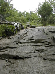
skyline trail


skyline trail
Originally uploaded by wereldmuis.


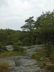
Despite my attempts to stay off the larger trails, I kept winding up on the Skyline Trail. I'd take a small track, and find it turning into nothing, and then just ramble around to get back to another trail.

I like this particular section of the Skyline Trail - very steep, a giant rock slab. Maybe not so much fun in the rain though.

I got lucky. Almost immediately after I got home, a drenching downpour started. I'm glad I got out today, anyway!

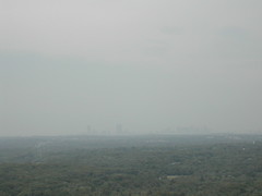
hazy boston


hazy boston
Originally uploaded by wereldmuis.


I didn't make any plans for the hike, and just wandered around looking for side trails, in the hopes of avoiding crowds.

I stumbled on this good view of Boston. Although, today it looked like a ghost city, barely visible in the haze.

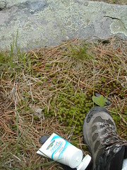
sunscreen


sunscreen
Originally uploaded by wereldmuis.


My hike at Blue Hills Reservation today was relatively short, only 1.5 hours.

It was a hot and steamy day, but rain was in the forecast. I went out around noon, when the weather was supposed to be at its best. There was a lot more sun than I expected. Fortunately, I had brought a tube of (hormone-disrupting) sunscreen with me.