I started early, decided to attempt a loop that would connect Mattabesett with the new Lone Pine Trail. I wasn't sure how long the whole thing would take, since Lone Pine is a new trail, not in my maps. But I planned on a max of 6 hours (so I'd turn around by 3 hours if I wasn't sure of the loop time, at that point).
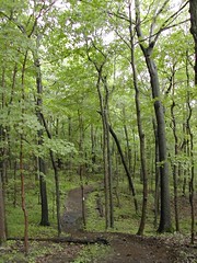
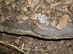
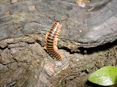
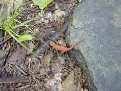
I parked at the Mattabesett lot off of route 77. The rain from last night had helped to cool things down, which felt good, though a bit humid. That first hike straight up off of route 77 going west is always a bit jarring, really gets the heart pumping. It was at the top of that scramble that I saw this weird little orange-accented millipede.
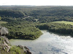
Soon after, I had my first fall, due to the damp and slippery rocks. I slid straight down a rock and landed on my butt, giving myself a nasty gash. My tailbone is still aching. After a brief pause to collect myself, I forged on to the lovely view of the Coginchaug Valley and Myer Huber Pond.
I was pretty sure if I kept hiking along the blue trail I must come to the Lone Pine Trail fairly soon, based on previous trips. Voilà, after 40 minutes of travel, I came to the first intersection with LPT, the white blazed blue-dot trail. The trail was flooded with a tiny stream here, due to the soaking rain of last night. I followed this branch of the LPT down to its intersection with the blue blazed red-dot branch.

The stream crossing along the way had become unmanageable, but I found a point close to the trail where some windfall could be used as a bridge. At the next point where the trail met the stream, the stones that I had used on previous trips were pretty well submerged. I didn't want to risk completely soaking my socks and boots, so I removed them to ford the stream. That was kind of fun!
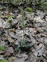
By the time I came to route 77 again, I had traveled for another 40 minutes. I took the red trail to cross through Braemore Preserve. Lots of Indian Pipe was coming up there, and along the trail in general.

It was in Braemore that I started to see salamanders along the trail (or were they newts?). While I was attempting to photograph one, I had my only encounter of the day with a human being - a guy and his unleashed dog. The dog was hostile, raising its hackles and growling. The guy laughed it off and assured me that the dog was just frightened. Riiiight.
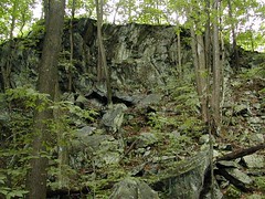
It took me another 40 minutes to get to the other side of Braemore, where there is an interesting rock wall that looks a bit like a wave. (It looks a lot more wavelike when you're standing beneath it.)
So, it takes about 2 hours to get from the route 77 lot to the edge of Braemore, close to where the Lone Pine Trail joins up with the Mattabesett again. At this point I was sure I'd be back to the car well before my max of six hours, so I hiked on. It was along this section of the Mattabesett that I slipped a second time, on another wet rock, this time bloodying my knee. It was just one of those days! Nice hike overall, though.
When I got home I took a nice soak in the bath to ease my aches. Great ending to a great day!
See more progress on: go hiking
2 comments:
my husband & I just hiked yesterday on the same trails you mentioned. (2 years later!)
We are new to hiking & enjoy it very much. 3&1/2 hours is our longest hike to date
I'm glad you're enjoying hiking - I am still quite an enthusiast myself.
BTW, the newest (2006) version of the Connecticut Walk Book does include a map of the Lone Pine Trail, now. I haven't done that trail in quite a while... I should get back over that way.
Post a Comment